Volunteers map sled dog trail with GPS
Published in Alaska Star on 1/8/2009
By DARRELL L. BREESE
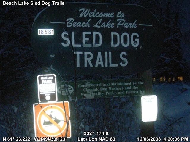
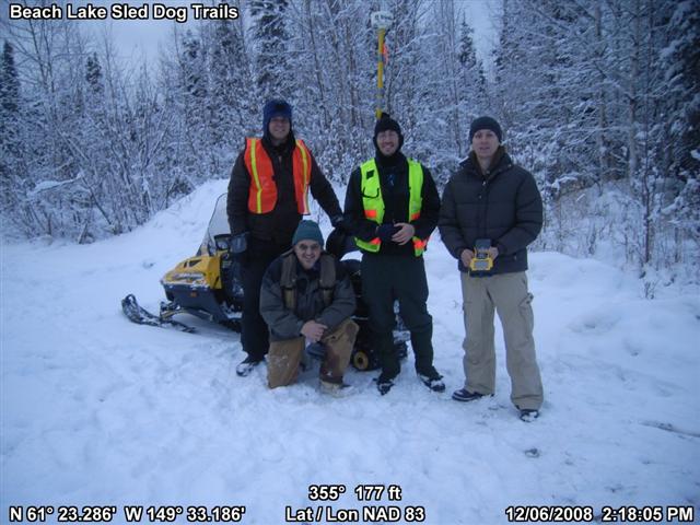
Members of the Alaska Arc User group volunteered their time and descended on the Beach Lake Sled Dog trails Dec. 6 with the goal of creating an accurate map of the established trail network.
“They (the Chugiak Dog Mushers Association) had a makeshift map of the trails, but they needed something more accurate,” said Joel Cusick, who coordinated the mapping project for the Alaska Arc volunteers. “The trails were updated last summer and the map was in need of some updating.”
“Our existing map is a rough sketch of where the trail goes that was drawn into an aerial photo,” said Lexi Hill, president of the Chugiak Dog Mushers Association. “Thanks to the efforts of these volunteers we’ll have an accurate rendition of our trails, showing their exact locations and exact distances.”
Working with the Eagle River-Chugiak Parks and Recreation Department and the local dog mushers, six volunteers, armed with GPS systems, set out to map the centerline, or middle of the trail, of the nearly 25 miles of Beach Lake trails.
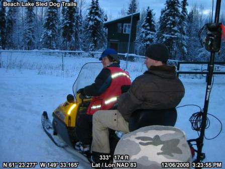
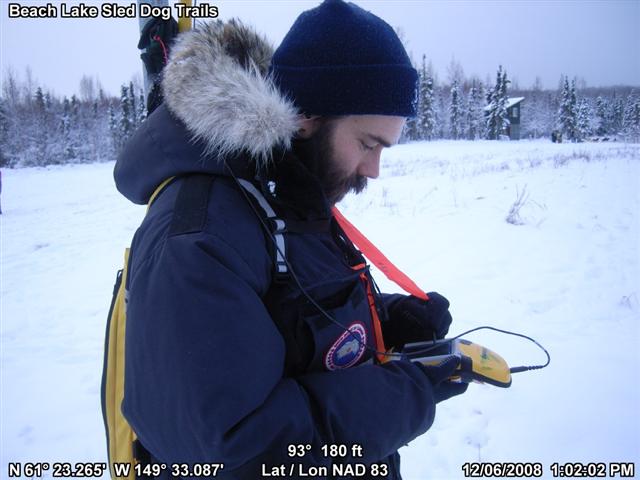
“I’ve been on the trails as a participant in the annual businesspersons sled dog race,” Cusick said. “But this time we used snowmachines and an ATV to get around. I don’t think we could have gotten accurate data on a dog sled.”
By mounting the $10,000 GPS mapping systems on the ATVs and snowmachines, the volunteers were able to collect the needed data in about six hours.
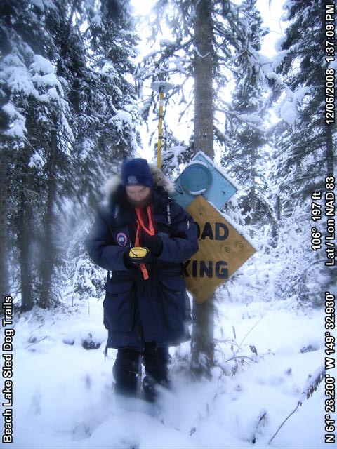
The mappers also used digital cameras to take photos of locations and significant trailside features, including signs, junctions and swampy areas.
“We could take the photos and the map data and make a virtual map in the future,” he said. “Our goal was just to collect the data. It’s up to the dog mushers club to make a map from the information we collected.”
A total of 25.3 miles of trails were documented during the mapping, including exact measurements of the various trail loops in the network.
Hill said the club will try to raise the funds needed to take the data collected and produce maps of the trail.
-End Story-
More technical notes from our user:
Using an all volunteer workforce from the Alaska Arc User Group
( www.ak-aug.org) user community, 5 mappers on December 6, 2008 GPS’d over 23 miles of dog mushing trails for the Chugiak Dog Mushing Club at Beach Lake, Chugiak Alaska. Chugiak dog mushing trail volunteers organized the logistics for us and drove the mappers on two snowmachine and All Terrain Vehicles for the day. Using three camera systems (one Ricoh, two Canon Elphi’s, 3 Trimble submeter GPS systems, TerraSync 3.2 software and a data dictionary compliant with the Interagency Trails Data Standards (ITDS) and Municipality of Anchorage Parks and Recreation trail system the mappers provided geotagged photos of trailside features and trail centerline data for the club.
GPS PhotoLink version 4.2.0 was used to process photos acquired by the three separate teams using a “PhotoPt” point feature designed in Trimble’s Data Dictionary. When a trailside feature was encountered – Signs for example, the mapper used TerraSync’s offset feature to ensure the position of the subject, and not the photographer position was integrated into the final product.
“The flexibility of GPS-PhotoLink is one of its best features, said Joel Cusick, past president of the Alaska Arc User Group and a certified Trimble Mapping Trainer. Since we had 3 separate teams mapping simultaneously throughout the dog mushing trail system, we just had to ensure we kept the camera tied to a particular mapper. Using an A,B and C, team approach, each Trimble rover file and the associate photos from that camera were processed to provide three geotagged feature datasets. Then, the three picture.shp files (an ESRI shapefile output possible in GPS-PhotoLink, were merged together and combined with all the tagged output after the mapping.”
Joel has been teaching Geotagging technology for over 6 years now and GPS-PhotoLink is the best software on the market to tag and manage photos.
Many lower end tagging software tools out there do not have the file management power built in. “You get what you pay for said Joel… “


