GPS-Photo Link Software Speeds Damage Assessment after California Fires
THORNTON, Colorado, USA. 6 December 2007 – The U.S. Forest Service deployed GeoSpatial Experts’ GPS-Photo Link software in the Cleveland National Forest to speed the creation of soil burn severity maps following the devastating California wildfires in October 2007. The software enabled Forest Service personnel to complete the damage assessment more rapidly than would have otherwise been possible, so that plans could quickly be made to protect surviving infrastructure from flooding, landslides and debris flows.
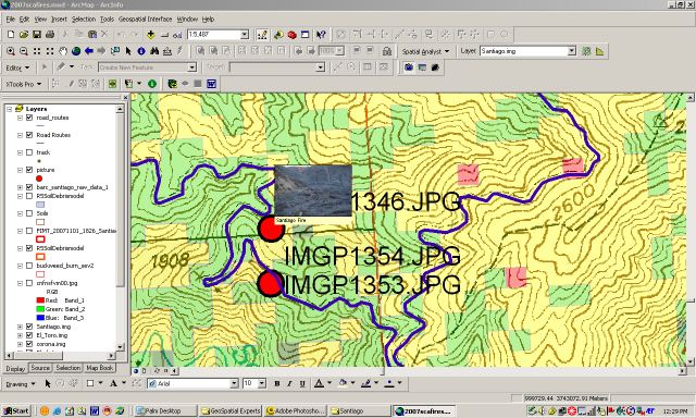
The GPS-Photo Link software maps digital photographs to their correct georeferenced locations in geospatial map layers. Requiring only a standard digital camera and handheld GPS device, the software links the photographic images with GPS location data and then accurately integrates them into a geospatial data set along with important attribute data, such as the time, date, and location coordinates of each photo. The software enables users to display their photo locations as icons in digital mapping environment, including GIS and Google Earth map layers.
The Forest Service office in the nearby Sierra National Forest bought the photo-mapping software from GeoSpatial Experts last year and uses it routinely in the activities of Burn Area Emergency Response Assessment Teams. Immediately following wildfires, these teams evaluate the damage and assess potential consequences relating to the heightened risk of uncontrolled water runoff over the exposed soil. This can lead to erosion, flash floods and debris flows that can destroy buildings, homes and buildings in the down-slope areas.
“We bought the GPS-Photo Link software primarily for use in our air assessments to verify the accuracy of BARC maps,” said Alan Gallegos, a Forest Service Geologist in the Sierra National Forest.
Development of a soil burn severity map involves several steps. Initially, a Burned Area Reflectance Classification (BARC) map is created using post-fire multispectral satellite imagery. The initial damage assessment is made by field teams on the ground in coordination with Forest Service remote sensing analysts examining post-fire multispectral satellite imagery.
The field teams classify individual burn areas by severity of damage and provide this information to the analysts to create a digital classification map of the entire burn zone. Accuracy of the BARC maps is then verified by aerial teams who photograph multiple burn sites from helicopters to determine if the severity of damage matches their classification. After the accuracy of the map is determined the map is then referred to as a soil burn severity map.
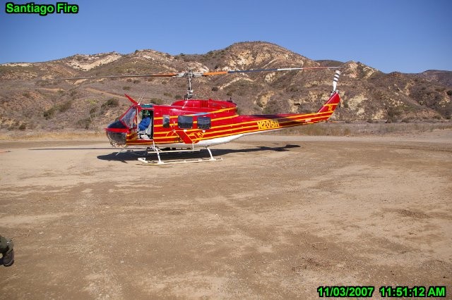
“Correlating the photos with their correct locations on the BARC maps was very difficult and time-consuming until we bought the photo-mapping software,” said Gallegos, adding that he took more than 400 photographs of the Santiago Fire burn area.
Gallegos explained that he now only has to upload his photos into ArcGIS where the GPS-Photo Link software is running, and the photo locations are immediately displayed as icons on the BARC map layer. During classification verification of the BARC map, the user just clicks on the icon to view the photograph so the degree of damage can be assessed visually. The GPS-Photo Link software has cut hours from this process, according to Gallegos.
“When we do BARC map validation, we can do it faster, and my colleagues think [the photo mapping] is the greatest thing they’ve ever seen,” said Gallegos.
Contact:
Linda Bobbitt
GeoSpatial Experts
Phone: 303.255.2908
Email: Linda@geospatialexperts.com


